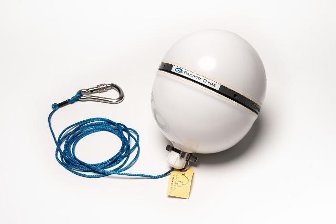
GPS Satellite Floats
Spherical multi-purpose Pacific Gyre GPS Floats are used in various environmental research and monitoring applications. It is designed to function on ice, or in water, making it suitable for diverse tracking purposes. Its typical uses include environmental studies, oceanographic research, and asset monitoring. The tracker's ability to support different telemetry systems, GNSS positioning, and various sensors allows it to gather and transmit valuable data for scientific research and monitoring activities in different environments.
Available with optional tether
Available in Multiple Sizes
Air deployment packaging available
For use in marine and ice environments
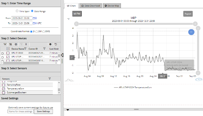
Data Telemetry/Archiving/Distribution
It includes data conversion to scientific units, a web browser interface with a dashboard map and current array status, convenient downloading, and device and organization administration. Data is archived on Pacific Gyre servers, and an API interface is available to download data directly to customer web pages or applications such as Excel and Matlab
Applications
- Tagging Ocean Debris
- Asset monitoring
- Environmental Studies
- Oceanographic Research
Features
- Enhanced location accuracy with GPS, GLONASS, BeiDou, and Galileo for global, multi-constellation navigation support.
- Floating hull, allows tracing in marine and polar environments
- Multiple telemetry options